The hike up Sahale Arm
to the Sahale Glacier has been on my
list for awhile. After all, the trail is absolutely picturesque, with
mountain vistas and deer grazing among the wildflowers. My hiking buddy,
Ernie and I had talked about climbing up to the glacier earlier in the summer,
but were diverted by smoke from Canadian forest fires. After the air had cleared,
the possibility of Ernie hiking with me this week was overruled by his wife,
Caroline. Turns out, she holds absolute veto power over all of the
legislation of the Ernesto, hiking or otherwise. Understandably, he
texted me to say he would be backpacking with his wife this week, thank you
very much, instead of hiking with the boys.
Disinclined to drive
that far and hike by myself, I sent a note out to Warren. I have gone on
long and distant hikes by myself before, but the conversation gets old and the
sleepy drive back a little dangerous. Luckily, from far away Lake Forest
Park, Warren answered the call. Sure, the deck needed to be stained, and
weeds needed to be pulled, but his answer to his wife, Lindsay was, in his
best Muiresque, Scottish brogue, "The mountains are calling
and I must go."
Then came a text
message from my oldest hiking buddy and best friend, Arie, domiciled on the East Coast: "In town to see the eclipse in Oregon next
week, what's up?" Naturally, Warren and I extended an invitation to
him. Warren was a good sport to be hiking with a couple of old guys on
the down side of 50.
From the Seattle area,
Sahale Arm requires an early start. Deep
in the heart of the North Cascades, it’s 125 miles away with the last 23 miles up
the narrow and slow Cascade River Road. The
trip from my house in Snohomish to the trailhead runs 2 1/2 hours. Despite its remoteness, and ample parking, the
trailhead lot fills up quickly. Warren
was at my house around 6 AM.
After picking up Arie, we were arrived at the trailhead just after 9. The
parking lot was more than half full. Since the trails are in the North
Cascades National Park, a permit is only required if you are camping
overnight. While a pass is not
necessary for day hiking from the Cascade Pass trailhead, other popular trails along
Cascade River Road are on US Forest Service land, and require the Northwest
Forest Pass.
As the three of us put
on our hiking boots, the morning air was mild but humid. Arie and Warren
elected to start off a little cool in shorts and tee shirts. I began with
long pants, mainly for bug protection, but zipped down to shorts after a mile.
The trail starts up emphatically through the trees. If Ernie were
with us, he would have counted 42 switchback up to Cascade Pass.
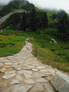
Eventually, the woods give way to steep meadow.
The hike to Sahale
Glacier can be divided into two distinct sections. The first carries you
from trailhead to Cascade Pass, then to the base of Sahale Arm. From
there, you can either go up to the glacier or down to Doubtful Lake. This
first half is a typical Cascade affair
of good trails through woods and meadows with a solid climb. The second
part of the hike takes you up the arm to Sahale Glacier Camp where real climbers
finish the job by bagging the peak, typically after overnighting at the camp.
Here the trail from the Arm up is rutted, rocky, and steep. The
intensity of the hike increases significantly the higher you go on the
mountain. While this might seem obvious, it is a consideration when planning for
this hike in terms of time and equipment.
Even though the
parking lot was pretty full when we arrived, we encountered only a few hikers
on the trail. We passed a couple in the first quarter-mile who looked
like they were starting off on a backpack trip, perhaps to Stehekin.
Along the way, Douglas squirrels and chipmunks wondered if we might have a
handout for them. Pika poked their heads up from the rocks as we worked
our way through slide areas. Even a vole scurried across the trail.
Katie, a 20-something
superhiker from Milwaukee, passed us with ease before the one-mile point.
It is always humbling for men of a
certain again to be left in a cloud of dust by younger hikers, especially ones
from the flatlands of the Midwest. In our minds, we're just a few years
older, not a whole generation. It wasn't until a blind and deaf
marmot stopped Katie in her tracks that we caught up with her and learned her
back story.
We came around a corner, and found her stopped completely in her tracks in what
appeared to be a semi-preyingmantis, defensive pose. For a moment, we
thought she halted for a bear stripping blue huckleberries on the side of the
trail. Arie and I had run into that situation at least once before.
A black bear had been reported a week ago in the area, but when hiking
with Warren, and his penchant for peanut-butter and honey sandwiches, I never
worry, even if he can outrun me.
"What
is it?" Katie she asked us quietly. Admittedly it was a
king-sized marmot that might have been mistaken for a porcupine or even a bashful
badger, if you had never seen a marmot before. He was big and bulky with
a severe overbite like John Elway in retirement, but harmless unless you happen
to be lupine.
Wearing
a Greenbay shirt, Katie fully admitted her Cheesehead allegiance, and that she
hailed from Milwaukee. When we told her we were impressed at how well she
climbed up the switchbacks for a flatlander, she kindly told us, she had been
hiking all summer. After four years of working, she was spending the
summer exploring the mountains of the west. This month she was hiking in
the North Cascades after Glacier and Olympic National Park in June and July. Katie thanked us for standing up to the marmot, but she was gone.
The next time we saw her, two hours later, she was heading down from the
glacier camp as we struggled upward. Ever gracious, she let us know that
it was steep up there. We wished her well on own personal journey of
discovery.
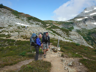
 |
| At Cascade Pass |
At Cascade Pass, we
took a left towards Sahale. One sign pointed straight for a 23 mile trek
to Stehekin. Another pointed to the right to a composting toilet, nestled
among some spruce, a BYO-TP affair.
From the pass to the base of the arm, the trail climbs through
open, sun-burning meadows. Lupine, columbine, some paintbrush, were blooming
among the heath and huckleberry. We were treated to another Wild
Kingdom moment when all of a sudden, marmots hidden all around us
began to whistle in panic. Were we scary enough to elicit such a
response? A bald eagle swooped down in answer.
Still further up the
trail, a doe, and at a safe distance off, her fawn, grazed among the flowers. We also encountered, Travis, the hipster
hiker, who had climbed the peak in Vans sneakers. He was cool if a little
reckless, and rescued Warren's sunglasses a few hundred yards down the
trail.
My best surprised came at the top of ridge, at the existential crux of the
hike. They spotted me before I recognized them. It turns out that when
Caroline said she wanted to go backpacking, she meant up to the Glacier Camp to
overnight. They had a spectacular evening
there, above us all, with an amazing sunset, the stars and
moon. Now they were heading down.
Ernie explained how the ever-shifting light of a night on the mountain
was worth the discomfort of the constant wind.
Caroline told us that
they had met Travis, too, and watched his ill-prepared climb across the glacier:
no traction, no poles, certainly no ice ax. They half expected
their beautiful experience on the mountain to be ruined by Travis taking a disastrous fall. Instead, they
watched his impromptu glacade back down the snow. No harm, no foul. We let them know Trav was pretty proud
of the X-games maneuver, telling us to look for his skid marks on the ice.
Ernie and Caroline also told us a mountain goat came up to their
camp, but by the time we made it up that, it had moved on.
Bugs
really weren't a problem on Sahale Mountain. The winds kept them mostly grounded. On
one rest break, I did knock a large if lethargic horsefly out of its orbit
around Warren head with my hat, only to watch it shake off the dust, and rise
again. We brought bug juice along because we had read about a plague of
flies from reports just a week old, but on our hike, it really wasn't an issue.
From
the trailhead to the Sahale Glacier, weather conditions changed from a mild and
sticky spring morning to a blustery, winter afternoon. Worse still, the trail
degenerated to a trace. Be prepared. Bring layers if you are going
to glacier. Don't be Travis. Poles and microspikes are essential.
On paper, with an
elevation gain of 4000' over six miles (one way), this hike appears to be some
work, but not exactly epic, like Mt.
Pugh or Three Fingers. However, comparing it to hikes of a similar distance or climb, say the
Kendall Katwalk or Mt. Si overlooks an important factor: trail
conditions. Up to Cascade Pass and to the base of Sahale Arm, the trail
is in good shape. However, as you ascend the Arm, the trail becomes a
muddy rut then degrades into a trace among rocks and
boulders. A section below the glacier camp brings you through loose
glacial till scattered across a steep slope. It was like climbing up a gravel pit, or a
Bruce Springsteen song, "One Step Up, Two Steps Back."
As we made our way up
the Arm, the wind picked up, and we felt the temperature drop precipitously. Feeling the chill, we added on layers. The jacket and long-sleeved insulated pullover that seemed like
extra weight at the sultry trailhead proved essential on the Arm.
As a middle aged man,
in pretty good shape, from hiking all summer, I found this part of the hike to
be quite strenuous-- ass-kicking, perhaps.
It was a little disheartening when we were passed by another Wonderwoman, a quarter mile below the camp. She was Summer from Oregon, adorned in
dream-catcher earrings and gauges. A snowboarder in the winter, Summer worked
on a trail crew in the off season. She was kind enough to take our
picture among the sand and gravel then headed on up to camp. Even for her that
last quarter mile was slow going.
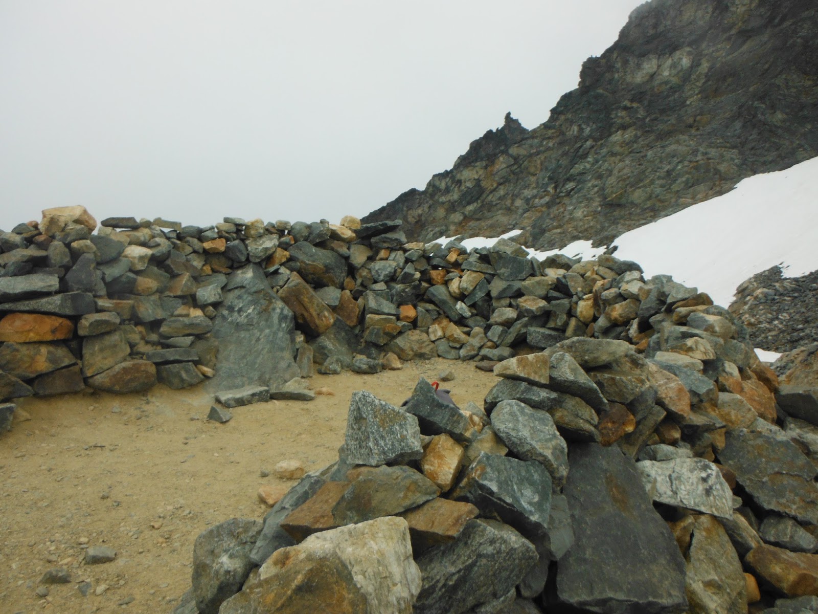
By the time we reached
the camp, we hunkered behind the rock wall of a camp enclosure. We meet Summer again behind the rock
enclosure, and shared our lunch with her.
I don’t think she expected the kind of conditions we encountered. She probably needed to pack more food. After a ten minutes or so, she headed down to
warm up.
 |
| Camp enclosures to slow down the wind a bit |
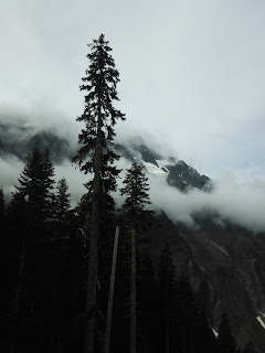
Sadly, fog shrouded
the peak, and we hoped that the peak baggers above, whose empty tents were
rattling in the wind, were fortunate enough to stand on top during a window of
clear weather. We didn’t spend much time
on the ice. Our fingers were going numb,
and we knew the first mile down would require focusing on each step to prevent
a broken ankle.
As we went hiked
down the mountain, the sky darkened, but the air warmed up. Just before we left the arm, we crossed paths
with a young couple, heading up. They
were toting their three-year old with them.
We let them know it was cold and rugged ahead. They decided to press on. Arie took a picture for them while I
worried about their decision to drag a little guy into those conditions. Fortunately, my faith in parenting was
restored with they passed us on the way down, just after Cascade Pass.
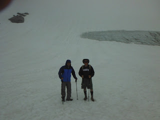 |
| On the glacier |
Even though it’s down
hill, the hike out, especially on the top half took some time. With tired legs, those switchbacks seemed to
double or triple in number. Eventually
though, we made it out. Back at the trailhead, clouds owned the
skyscape. Despite the work, we agreed it
had been an awesome adventure.