Monday, December 26, 2016

Tiger Mountain Train Wreck on the Winter Solstice


After reading about the Wood and Iverson Logging Railroad, in Ken Smeltzer’s book, and the 1925 crash on Tiger Mountain, my lifelong hiking buddy, and best friend, Russ and I decided to hike to the site.   There is an easy way, where your SUV will do most of the work, starting at the Hwy 18 summit, and then there’s the way we went, beginning at the bottom of the mountain, off Tiger Mountain Road, near Hobart. 
Trailhead off Tiger Mountain Road, near Hwy 18
With Tiger Mountain, like any hiking oasis near an urban area, signage is problematic.  Are signs missing or never placed?  I suspect stolen by punk vandals, souvenir seekers, and NIMBY neighbors of the park.  Regardless, it is a reality on Tiger Mountain.   The hassle begins with the unmarked trailhead itself.  After turning onto Tiger Mountain road, off the Hobart Road near Hwy 18, look for a bus stop sign a quarter mile up on the right, before 175nd.   Since we were the first people to arrive that morning, we didn’t have the benefit of seeing a slew of Suburus parked on the opposite side of the road.  We drove past the first time, but quickly corrected our mistake, and were on the trail by 10:40 AM or so.
Lower part of the Tiger Mountain Trail (TMT)
We began our hike on the unmarked southern terminus of the Tiger Mountain Trail (TMT).  Given the fact that we hiked on the Winter Solstice, trail conditions were outstanding.  The trail climbs up along a canyon among maple and fir trees.  For equestrians, a horse cut off is available for surer four-hoofed footing.   Where the Horse Cut-off rejoins the TMT  (just over a quarter mile) is one of the first confusing intersections of the hike.  To the left is an old logging road heading down the Tiger Mountain road.  To the right, the gentler TMT works around the eastside of the South Tiger prominence.  We elected to take the steeper, South Tiger Traverse.  You may find it odd that the steeper trail is called a traverse, but such are the irritating inconsistencies of Tiger Mountain. 


View from the Pipeline Trail Looking West

In just under a quarter mile, the Traverse trail intersects with the Powerline Trail.  A nice panorama through the high voltage lines can be enjoyed here.  When we walked up to enjoy the view, we encountered Oscar the grouch at age 60.  We could tell he was none too happy to see us because he snarled and snorted when we walked over to enjoy the view. I asked if he was also heading up to the train wreck, he told us whichever way were hiking, he was would going in opposite direction.  “I am he was out here to be alone!” he growled.    In the most popular hiking destination in the state, I doubt he was going to find true solitude. 

While Oscar headed down the Powerline Trail to rejoin the TMT, we began the ascent up the South Tiger Mountain Traverse, moving in an out of logged areas and second growth forest, past a pond, and a memorial to long-time property owner, and conservation advocate, Carol Hepke.    Once we climb to the ridge, just below South Tiger summit, we were confronted with another signage question.    Where the hiking trail meets a road, a sign reads “Tiger Mountain Traverse,” pointing back the way we came, suggesting the traverse was at its end.  That would make the road we popped out onto the West Side Road.  In the icy crust on the road, we found tire tracks of some local chapter of a  jeep club.  The road had seen enough traffic to create pass-like conditions of snow and ice.  It turns out, though, this really was NOT the West Side Road, but just a spur that petered out in a quarter mile.  It took us awhile to figure this out.  To the right, the spur heads towards the summit of South Tiger, Y-ing slightly, holding the summit in the crux of the Y.  

Where the TMT and the South Tiger Traverse Meet

From where we were standing , we could not see where the spur ended.  Consequently, we searched in vain across the road to where we believed the trail would continue to the train wreck.  In actuality, the Traverse continues down the spur of the slippery old logging road to the left for another quarter-mile , first to the junction of the Traverse and the gentler, TMT, and then through a broken, and open gate,  where the spur meets the actual West Side Road.   When we came off the trail, onto the spur, given the sign and the fact two different maps did NOT show the spur continuing toward the South summit, we were confused, and thought the “Artifacts Trail” should be just across the road.  We ponder our location and the accuracy of our map, and then decided to at least tag the top of this part of Tiger.  Honestly, at 2028 feet, South Tiger Summit, is just a couple of benches around a fire pit with a partial view of the valley.  It is not a great final destination for an otherwise, great day of  hiking. 


South Tiger Summit 

We still had 45 minutes before our agreed upon turn-around time of 2:30, so we backtracked a bit, and worked out that we hadn’t come to the end of the Traverse as we guessed.  Once we realized that the road spur was a continuation of the trail, we tread our way down the icy path.  Russ demonstrated the hazards of the footing by doing an impromptu cannonball onto the road.  Arms out, arse first, he quickly hopped to his feet--no harm no foul, though some microspikes on that little chunk of road would have been nice.  I was happy I was using poles. 
Route of Hike with Spurs Added 
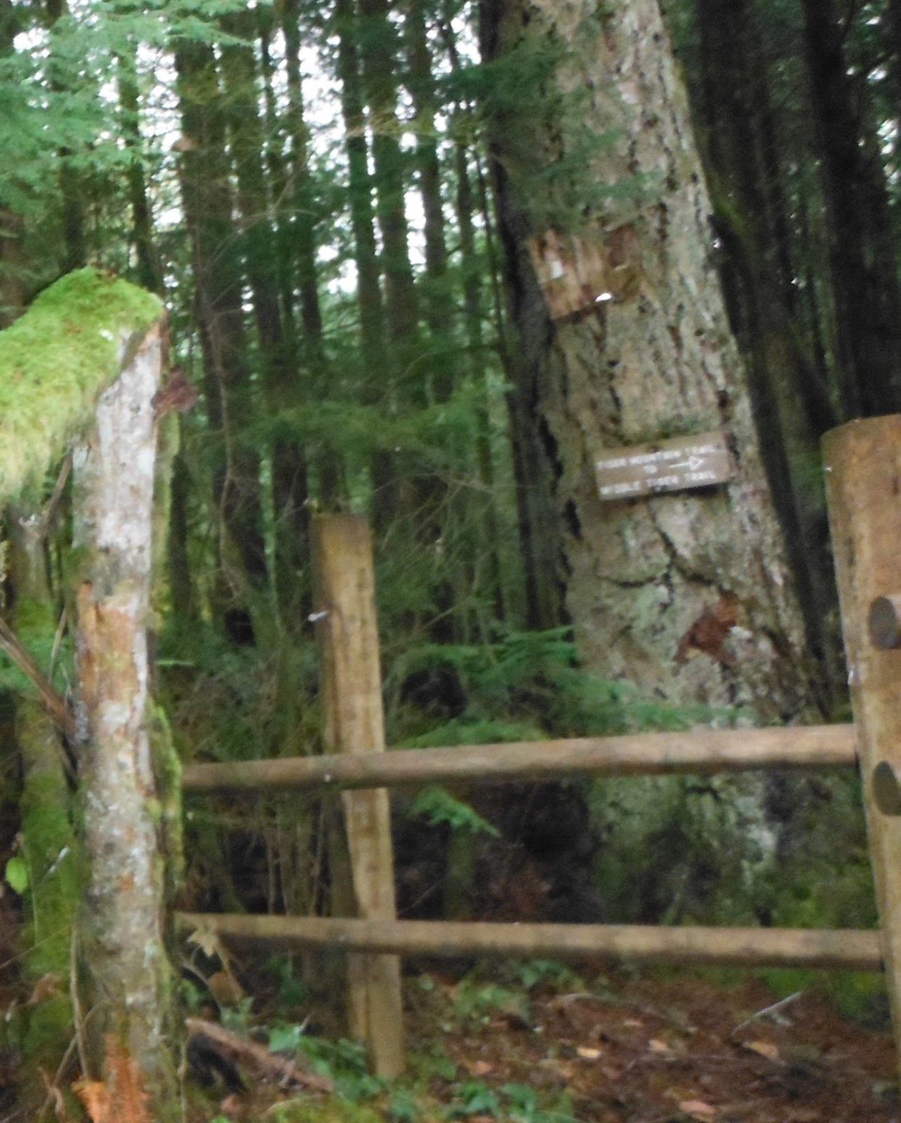
Down the West Side Road 30 yards or so, you'll find
the stile that marks the continuation of the TMT, on the way
to the 1925 train wreck site.
After a few hundred yards, the Traverse officially ends as it converges with the Tiger Mountain Trail again.  The TMT then crosses the actual West Side Road. Up the old logging road, we ran into Oscar again, now mellowed a bit by the workout.   Here again, our maps were a little inaccurate.  It appears that the trail should continue straight, but in fact, you need to walk down the road (to the west) for 30 yards or so where you’ll find a stile where the TMT continues.  From the stile to wreck is just over a quarter of a mile.  

As the trail continues, it climbs the ridge a little then curls back east towards Holder Creek.  After a quarter mile or so, on the bank of the creek, you’ll find a sign informing you that you are on the Artifacts Trail that follows the old grade a few hundred yards into the woods.  Here the remains of the 1925 crash are strewn in the dark second growth forest for hundred yards or so.  At
the wreckage site, you find another sign marking the spot of the accident.  This was the only place where we found deep mud on the trail.  

Parts of the undercarriage, and the twisted remains of a car wrapped around a tree provide a vivid reminder of the violence of the crash.  We paused in silence for a moment honoring the Nick Karis, who died in 1925 crash.  He was born the same year as my grandfather, but only lived to 35.  Two other loggers jump from the train in time.  Nature and souvenir hunters have pilfered the artifacts.  Still, anyone with an historical imagination can visualize the dangers and difficulties of logging on Tiger Mountain almost 100 years ago.

We snapped some pictures and checked our watches.  It was 2:30 and time to head back down.  This time we took the easier TMT all the way out.   If we had taken the TMT up, we would have by-passed the confusion of the Traverse signage and the maps with missing spurs, but we would have also missed out on the adventure, and the cardio benefit of taking a trail less traveled.

In a little over a mile down hill, the TMT zags across the pipeline trail.  In the dimming light, on the lower part of the path we ran into two separate hikers with their dogs and no headlamps.  They must have great night vision to head into the darkening woods that late.  Just a half mile or so from the trailhead, we had brief conversation with a UW Wildlife biologist who heading up the trail to check his wildlife cameras. 

“Any cougars?”  we wondered. 

“Not on Tiger, surprisingly,  but over by the Raging River.”


We were back at the trailhead just after 4 PM.  It was winter solstice.  The sun would be down in 15 minutes.  We agreed it was an excellent day of hiking however brief.

Monday, August 22, 2016

Mailbox Peak: A Tale of Two Trails


Mailbox Peak is one of the most popular hikes on the Mountains to Sound, I-90 corridor, yet it is a tale of two trails, one old, mean, and haggard, and another new, attractive, and well-kept. Oddly enough, it's the Old Trail that draws so many hikers to it.

Unfortunately, interminable roadwork (see link to schedule below) has limited access to Mailbox Peak for the past couple of years which means on a beautiful Saturday morning in August, all humanity was making their way up the mountain.  The truly international nature of Seattle's economy was on display last weekend when I went up,  as high tech workers who harken from different states, countries, and continents converged on the mountain.  I felt like I was in a great 60s convocation promoting peace and harmony,  or perhaps a Coke Commercial where the singing had been replaced with an international chorus of grunts, and raspy conversations as determined engineers of various disciplines, sweated their way up to a mailbox 4000 feet above them. For many of newcomers, Mailbox was their introduction to hiking in the Pacific Northwest.  What a terrible first hike for those thrown onto the old trail by "work friends."
Mirkwood:  The view along the Old Trail
The Old Trail is a decommissioned  trace up a nondescript mountain.  Cut by climbers and firefighters who lives depended upon maintaining a high level of physical fitness, the trail goes nearly straight up the mountain, climbing 4,000 feet in 2 1/2 miles through a dark tangle of a former clearcut.  No consideration was given to erosion or aesthetics when the trail was hewn along steep slopes.  Like miners' trails, the Old Trail is a bushwhack of the straightest line possible to its destination.  I rarely say this about any trail, but it is ugly.  The last loggers to clearcut the mountainside left it for nature to heal the gash.  Consequently, a great overabundance of seedlings sprouted up, each competing for sunlight and nutrients.  The result is a dense, unhealthy under-canopy devoid of biological diversity.  Maybe, though, it doesn't matter since the slope is so severe, there is very little opportunity to look up and smell the western hemlocks.

Look for the Diamond Blazes Along the Old Trail.
The trail sign shows the old trail as un-maintained.  It is a mess.  Yet yesterday,  it was busier than the New Trail  The Old Trail drips with machismo.  Prove your burliness to the world, and say, "I went up Mailbox via the Old Trail."
Hikers Spread Out Along the OLD TRAIL

When I went up, Joe, the Handicapper General, was doling out extra weight in the form of waterjugs and cans of food by the official trailhead.  Part of the Mountains-To-Sound Greenway project,  Joe solicited hikers to ferry supplies up the mountain.  When he asked me to carry a gallon of water up, I pleaded old age and negotiated my way down to a can of coconut milk.  "Every little bit helps," he told me as he sent me on my way.   On the hike to the Mailbox, I passed younger and stronger hikers struggling to carry a couple gallons of water to a cache point where the two trails converge and half mile below the top.
The Trailhead Map Shows the New Trail in Red.

The Old Trail begins a little further up the access road.  The New Trail has a trail map emphasizing its safety and advantages whereas the old trail features a warning sign of its hazards.  According to a Seattle Times report last spring, Mailbox Peak  was the worst trail requiring Search and Rescue operations in King County  (See Seattle Times, June 10, 2016).  I suspect this has more to do with number of neophyte hikers on a ridiculous trail than anything else.
When you come out of the woods, the summit still looks a long way off.
Don't be disheartened.  Things are closer than they appear.
While the Old Trail begins on the verdant edge of the forests, things quickly turn gray and dusty.  The trail follows more or less a straight line up the hill.   I found the crowded second growth hemlock held in heat and humidity even at 8AM.     I left my sunglasses and hat in my pack and focused on the trail and diamond blazes on the trees though I only occasionally found the markers helpful.  More typically, the path brought me to the marker rather than the marker kept me on the path.


Along the New Trail
To gauge my progress in a nearly featureless landscape, I used the the altimeter on my Suunto watch. The trail begins around the 900 foot level and climbs to a little more than 4800 feet.  On a typical hike, I use time as my measure of progress   I can normally count on two miles an hour with elevation gain on a decent trail, but I was unsure of the effect of the rapid ascent, and poor footing would have on my hiking pace. Turns out, using my poles and the the lack of any undergrowth on the trail meant my time was about the same as say hiking the equivalent distance over better terrain.  That being said, it was good to see the progress on the altimeter and it encouraged a group with a tired hikers in the depths of Mirkwood.

As you climb, the trail moves south and then mostly east along a ridge line to a final convergence with the new trail perhaps a half mile below the summit.  On Saturday, many of the hikers were clueless about the challenge.  1,000 feet of elevation gain per mile is difficult.  1,600 feet per mile is a gut buster.  Judging by their new boots, beach totes, and Juicy-Juice boxes,  many of the mailbox trekkers were on their first hike.  Generally, their fitness level didn't match the rigors of the trail.  Was this a cruel hoax played by outdoor enthusiasts at big high tech firms to discourage new hikers?  After all, the trails are getting very crowded, and so many of the people on the hill were from some place else.  Can you imagine the conversation around the water cooler?

New Hire:  I would like to try hiking this weekend.
       
 Old Hand:  I know the perfect hike for you, MAILBOX, if you think you're tough enough.

The brand new hikers also fell prey to the handicapper general at the trailhead.  If people said hello, he asked if they would be willing to take up a gallon of water  (8.34 lbs) to the depot at the convergence of the two trails.  I accepted my can of coconut milk, but I met a young firefighter from Arizona, in new boots, who carried up two gallons to the cache.  God Bless him, but I think he underestimated the challenge, as this 50-something hiker chugged past him at about the 3500 foot level.

Removing Graffiti from the Rocks below the Summit
Others I passed carried nothing.  Not even water.  Someone was hydrating with a Juicy-Juice box.  A few were superfit.  Was it my imagination, or did that guy have a German accent?  A part-time mom and full-time Jazzercise instructor went bombing up the hill with her entire family.  She had the dog.   Dad carried the water.  Their son dutifully worked his way up the hill, but his teenage sister told her folks, "Yes, I know I can do it.  I just DON'T LIKE IT!"  Mom, as a fitness expert knew if her daughter could talk that much, she wasn't working hard enough.  While the family got a great workout, I'm not sure if the next generation was inculcated with a love of the great outdoors.  I think the Swift Family Robinsons spent ten-minutes on top, then turn back down the Old Trail.
The Well-Maintained New Trail:  Light in the Forest
When you finally come out of the dense woods, about the 1/2 mile and a thousand vertical feet from the top, you'll get your first glimpse of Mt. Rainier before you head briefly back into the forest.  The trail curves south again into steep meadow.  You can now see the top of the peak, but it still looks a long way off.  Honestly, though, the last little climb up the dusty trail, with sweat stinging my eyes, took maybe ten minutes.   For a few though, it was disheartening to see how much work still needed to be done.
This view makes the work seem worthwhile.
A few flowers decorate the way through the meadow: lupines and Indian paintbrush.  Unfortunately, so did some graffiti freshly sprayed on rocks.  You never see this on trails further from the city.  It's unbelievably thoughtless, and I am at a loss to explain why someone would deface nature the same way they would tag a dirty wall in an urban setting.  Luckily, a good Samaritan saw the vandalism the day before, and hiked in with paint remover and a steel brush to erase it.  As busy as the trail is, I was disappointed other hikers allowed it to happen in the first place.
What's in the Mail?

Once you get to the top, people pose by the Mailbox crammed full of mementos.  Even though I got there fairly early, the summit had a population of a small mountain village.  No one really checked the mail.   Supposedly, there's a register inside the box, but it must be buried by the junk mail.  At any rate,  I would think a notebook would easily fill up in one weekend.
Nearby Rattlesnake Lake and Ridge
A number of peaks are visible from the top of Mailbox. Nearby, to the northwest is Mt. Si.  Due west is Rattlesnake Lake with Ridge above it.  To the south the great majesty, Mt. Rainier, was out in full glory, making the hike seem worthwhile.  What a disappointment it must be to hike up into the clouds.
Along the New Trail
After enjoying the vistas and a light snack on top, I headed down the New Trail, which doubles the distance out, but saves your knees.  I can't say enough to contrast the two trails.  If my ego wasn't so pathetic, I would have taken the New Trail to go up the mountain, too.  It is well built, and the forest it travels through is healthier with more air, light, and life along the way.  Two bridges cross a small mountain stream. Occasionally, views of the valley and distant mountains open up.  If the hike is about the journey, and not proving yourself macho, then the New Trail is by far preferable to the old.
Given its closeness to Seattle, the challenge it represents, and the amazing views from on top, Mailbox Peak will continue to be one of the most popular hikes in the Northwest.  Hopefully, more people will hike the new trail up to the summit as well as down.

The Panoramic Vista From Atop Mailbox Peak

Here are the driving directions from the Washington Trail Association:

Driving Directions

Take exit 34 from I-90. Head north on 468th Ave SE for approximately half a mile until the intersection with the SE Middle Fork Road. Turn right onto the Middle Fork Road. Follow SE Middle Fork Road 2.2 miles to the stop sign at the junction with SE Dorothy Lake Road. Head left onto SE Middle Fork Road and drive .3 miles. Take the turnoff to the trailhead on the right and continue a short distance up the paved road to the paved parking lot with 40 spots and a vault toilet.
Here's a link to the Federal Lands Highways project for ROAD CLOSURES on the Middle Fork Road--the only way into the trailhead.


Thursday, August 18, 2016

Suprise and Glacier Lakes below Stevens Pass.

Panoramic view of Lake Surprise
Surprise and Glacier Lakes are two underrated destinations near Stevens Pass.  On the WTA website, local hikers and backpackers have rated it a 3 out of 5.   Both lakes are beautiful and the Surprise Creek trail is in great shape. Could it be the elevation gain (2700 feet--900 feet more than Snow Lake (Snoqualmie Pass) and double Lake 22) or, ironically, the popularity of the trail that makes many hikers dismissive of this hike?   Maybe I'm an easy grader, but I would give the hike at least a 4 out of 5.   That being said, there are a few annoying signage issues about the trail .
Surprise Lake Trailhead is off Hwy 2 ten miles past Skykomish
The first issue is the trailhead. The guidebook tells us we can find the start of the trail 10 miles past Skykomish on the right, near the site of old Scenic, Washington. Don't look for a sign for Scenic. Trust your odometer. There are no signs at the turnoff indicating anything, except, "Emergency Parking Only." On opposite side of the highway, nearly even with the turnoff, is a sign for the "Iron Goat Interpretive Site." When I went up yesterday, all I saw was a construction crew working on the railroad crossing, under a sign that read, "PRIVATE RAILROAD CROSSING. NO TRESPASSING." When I asked if this was the way to the trailhead, the crew wasn't sure, but let me go by. Sure enough, in less than a half mile, I was at the trailhead. There were probably a half dozen cars already there.

The hike begins under humming powerlines.
The hike begins inauspiciously, under the hum of powerlines, but quickly turns into the forest where the shaded trail is outstanding, complete with boardwalks and steps. Soon the sound of the rushing creek replaces the noise of the highway. Blue huckleberries abound along the side of the lower half the trail.

The first half of the Surprise Creek Trail is in excellent shape.

Eventually, though, some work needs to be done to get up to the lakes, and the trail steepens as promised. The loving attention it got the on the lower half disappears. It's still in good shape, but the steps and boards have been replaced with rocks and roots. Even in August, small streams cross the trail. That being said, the bugs weren't bad yesterday.
Blue huckleberries Abound Along the Lower half of the trail.
Just before the lake is the cutoff to Rattrap Pass to the left. The old sign also points that way to Scenic Lake (another name for Glacier). Stay right. No one seems to use that spur much. The PCT hikers I met were coming down the Glacier Lake trail.  One of the guys needed to get to Stevens Pass where a box of provisions was waiting for him.   He looked emaciated, and seemed to need more than a few freeze-dried meals to recover. After he picked up this supplies, he told me he was going to have to  hike back up to where he left off.  Such is the cross carried by the PCT through hiker.  He had come a long way from Mexico only diverted from his quest by  some wildfires along the way. 
The rarely-used Trap Pass Trail climbs the ridge to the left.  STAY RIGHT!
Once you take the Y to the right to Surprise Lake, you'll need to cross a branch of the creek from east to west (left to right). A myriad campers' trails can create a little bit of confusion along the lake, but the main trail runs along the east shore. Four or five groups were either breaking camp or setting up when I came through. What a great place to spend a night in the mountains! The water is a lovely emerald green. A few trout splashed after flies. However, I was headed to the higher lake.
Emerald green and clear, Surprise Lake
An important clarification to the guide for folks who want to head up to Glacier Lake: the trail to Glacier is only about a third of the way down the shore. A sign seems to point left to the toilet and right to Glacier. This is wrong. In fact, to get to either, you need to veer left. The sign is confusing enough for someone to have scratched another arrow to indicate the trail to Glacier begins to the left. Continuing straight will only take you along several more campsites along the lake, terminating in a boulder field.

Veer left about 1/3 up Surprise Lake to Hike to Glacier
The trail to Glacier quickly climbs the ridge. Just after the trail crests, you'll see Glacier Lake glimmering to the right. Look for the "CAMP" sign to access the lake right away. The old, metal Forest Service sign, "Glacier Lake," is a few yards in the woods, tacked on a tree, and not visible from the trail.
Access Glacier Lake from this trail
towards the southern end of the lake.
The Glacier Lake sign cannot
be seen from the trail.

Glacier Lake is bigger, bluer, and colder than Surprise. I took a quick dip, encouraged by a horse fly the size of a quarter, and a few confused hornets. They buzzed by but didn't bite. I kind of the thought the extra work would buy more solitude, but it really didn't. As I ate my lunch, a couple more campers arrived with a dog. A rider also rode up on horseback.
Glacier Lake panoramic
Eventually, I turned back down the trail. At the end of Surprise Lake, I had to find the right trail to cut back to the east (now right side) across the creek. As I marched down the trail on weary legs, I watched my altimeter indicate my slow descent. It was a hot day. I was thankful I brought a filter to replenish my water supply from the creek. Eventually, I could hear the freeway, and then the humming of the power lines. Sadly, back to civilization. The distance, elevations, and beauty of the Scenic Lakes can fill up your day. I was sorry I didn't overnight it. Maybe then, I would give it an 5/5.

Sunday, August 14, 2016

A Hike into Nostalgia: Monte Cristo and Silver Lake


This week, my best friend from the Paleolithic era, Russ, was back in town.   He and I grew up exploring the Cascade Mountains back in the day of the canvas ruck sacks and Sierra cups.  We had planned to hike on Wednesday, but cloudy weather discouraged any peak bagging.  Instead we decided to take in a little history at Monte Cristo and some awesome scenery at Silver Lake. The hike also provided relative solitude as we encountered only a few folks on the trail to Monte Cristo, and no one hiking to Silver Lake.

In the last decade of the 19th Century, a couple of miners found a tantalizing strike along 76 and Glacier creeks.  It didn’t take long for the cycle of boom and bust to turn a full revolution in a town named after Dumas’ fictional count.   There was an attempt, after the industrial dreams of the Rockefeller and his cronies dwindled, to turn Monte Cristo into a wilderness resort.  The Great Depression ran a sword through that hopeful notion, too.  Railroad access ceased.  In the end, rustic campsites sprouted up like mushrooms after a rain, providing  some  recreation for the working families of Everett in the decades following WWII.  Eventually though, Cascade storms destroyed the easy road in and Monte Cristo became a ghost town.  For more information on the history of the town, check out the Monte Cristo Preservation Association website: http://mc-pa.org


"Stink Currants"  
Note the maple-like leaves.  Blueberry leaves are oval.
The hike begins at Barlow Pass, 30 miles down the Mountain Loop Highway from Granite Falls.  To make the drive a little longer, one patch of road was reduced to one lane traffic.  Because of its relative isolation, prominent signs warn of break ins, so leave nothing to entice methheads.  I just leave my old dry cloth on the backseat and not in a bag.  A Northwest Forest Pass is required and a privy is provided in the parking area, but BYO-TP. 

The old road to Monte Cristo is still the hiker’s path to the town.  It's an easy grade up, and well-shaded.  Not very long ago bicycles outnumbered hikers on the road to the town site, but monstrous winter storms washed out access to the first bridge, and ate at least a quarter mile of road away, so the teams of  families and kids on bicycles have disappeared. 

The washout creates the only real challenge of hike below the town.  We found the best place to cross the river was behind the privy right before the trail to Gothic Basin begins.  A little rock ramp and a log carries you across a small channel of the stream and onto a dry bed of boulders to navigate before hopping onto the old bridge to get back on track. The second bridge is just ahead.  The two bridges carry you over the deeper channels of the river, but I imagine earlier in the summer, when the water is high, the safer route would be walking up the new road that starts just past Barlow Pass.
 
The washed-out first bridge
The walk to the town didn’t seem to take much time even with Russ taking a lot of photographs along the way.  He has an artistic eye and moved away long ago, so he enjoyed  the chance to reconnect with the flora of his youth.   The old road is pleasant with occasional views of the river and a nearby mountains.  In August, we found some thimbleberries, and two types of currants (red and stink) fully ripe.  Russ sampled the thimbleberries. The stink currant looks a little like a big blueberry, but its pungent, medicinal smell should discourage consumption.  At any rate, I waited until we came up to the huckleberries for my Euell Gibbons moment.

Three young school teachers passed us on the road to picnic among Monte Cristo's relics rusting into oblivion. The few people we met at the townsite seemed to know that Frederick Trump once owned a hotel in town when gold fever was in the air. 


Steep switch backs to Silver Lake,
1300 ft of elevation gain in  couple of miles
From Monte Cristo, the trail to Silver Lake goes up in earnest. As 50-something hikers, we were glad to have our trekking poles for the second half of the hike. Most of the 2000 feet of elevation gain occurs ascending the ridge. It had rained the night before, and a myriad of mushrooms were emerging. Red, then blue huckleberries made for better snacking along the way up. 
             
Silver Lake 
After working up the switchbacks, we crested the ridge, and dropped down to the lake. The long, slander waterfall against the red rocks of the mountain, with mist drifting down from Silver Peak, created a picturesque scene. The solitude was also nice. When we were there, only one group was camping overnight at the lake. We ran into them as we were leaving. They had ventured to Twin Lakes that morning.


Lower half of the town site
The same pitches that worked the heart on the way up, worked the knees on the way down.  Again, we were thankful to have our trekking poles with us.  Our solitude was interrupted by three dudes with speakers blaring gangsta rap.  They complained about the steepness of the trail.  I bit my lip about the noise. In a switch back or two we could enjoy the quiet of the forest again.  Of course, I might have been less philosophical about it if I were camping by the lake next to them. 
Vandalized Guide Cabin

We we made it back into Monte Cristo and explored the other side of town, across the bridge and up Dumas Street.  A few cabins remain.  Keep Out signs try to protect the town from vandals.  Most of the buildings are gone, but other signs indicate where once stood the school house, assay office, black smith's shop, and hotels.

We were just about to call it a day, and head down the road, when a father and his twenty something sons came towards us for a little show and tell.  They were mining enthusiasts from 100 miles away, and had hiked up to the abandoned mines on the other side of the creek.  On one of the picnic tables, they laid out maps and photographs they had found on the internet.  They had a real Treasure Island excitement about their trip.  Much as we enjoyed the history lesson, we wanted to get back to our car before dark. 
Even though it was easy going heading back down the road, the distance seemed longer.  We met a couple of young women only a mile or so from the trailhead.  It was 6 PM, and they told us they were heading up to Gothic Basin.  They had a lot of work ahead of them, and would be pitching their tent in darkness. 

Old Monte Cristo Road

When we got back to the car, we were happy to see everything intact.  After the long road back. we stopped in Granite Falls for some tasty Mexican food at Playa Bonita and rehashed a great hike.  We decided it was worth the distance and effort.  While further down the Mountain Loop Highway, and certainly a longer hike compared to crowed Lake 22, Silver Lake is a great alternative with history, vistas, and a degree of solitude.