Saturday, July 29, 2017

Mount Dickerman v. Mt. Si. Which is the better summit hike?

Your Destination, the top of Mt. Dickerman,
still 800 vertical to go!

Woke up yesterday to a heavy marine overcast in the lowlands, so I considered changing my hike to a lake or waterfalls.  After all, summit hikes are a little pointless if the peak is socked in. However, the purpose of this hike was primarily conditioning for a later backpacking trip in August, so I decided to stick with Mount Dickerman.  It turned out to be a great decision.  By 10 AM, the clouds had burned off, and on top, it was absolutely glorious with views from Baker in the North to Rainier in the South.

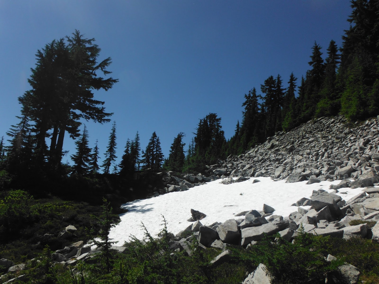
The trail is fairly rugged in places with rocks, roots and a couple of easily maneuvered blowdowns.  The little streams and cascades that cross the trail are mostly dry now.  There's really no safe and easy way to filter water on the hike.  Bring plenty of water with you.  
The Woods are lovely, dark and STEEP!

Along the way, I passed a few people struggling somewhat on the trail.  I think folks, perhaps new to hiking, don't recognize the fitness level required to enjoy a trek of this rigor.  Build up to it with less aggressive day hikes.  I would suggest hiking Lake 22, or Lake Annette then heading up to Pilchuck, etc.  If you can hike a trail of week, and make each one a little more challenging, in a matter of weeks, a grade like Dickerman will feel like work, but not a death march.
About 45 minutes into the woods,finally a viewpoint

The Mt. Dickerman trail is steep for the first hour through the woods.  It flattens out for a short section, then gets steep again near the summit.  Nearly 4,000 feet of elevation gain over four miles is a lot work, especially on less than perfect trails.  For comparison, Mount Si climbs 3150 feet over the same distance, and people call it "a slog."  My friend, Ernie, the Calculus teacher informed me that the Dickerman trail has 55 switchbacks.  I have not counted them, but I trust his numbers.
The trail flattens out in the middle

On trail with me yesterday morning was a scattering of ten or so older and wiser hikers who knew to start early before the blazing sun begins to roast everything on the southern slope. Most of the people on the trail were also Seattleites  who had headed north to the Mountain Loop Highway because of growing mobs on Snoqualmie Pass trails.  I suppose in five years, crowds will hover around Mt. Dickerman like they do around Mt. Si.

A bear had been reported on the mountain earlier in the month.  More than half way through the woods, I was stopped by a dark stirring in the vinemaples, very reminiscent of my last bear encounter on the shoulder of Mt. Baker last summer.   I paused, and raised my trekking poles to clang them together.  I turns out my bear was a rather petite woman, returning from a call of nature. She looked at me aghast.  I told her, thinking of an old Remington drawing, "I took ye for a bar."
                 She growled at me.  I certainly didn't mean to compare her features to a bear:  she would have been more of a petite cub, but the rustling in brush gave the effect of a bigger bruin.

A couple of women further on trail took exception to my comparing Mt. Dickerman to Mt. Si.
"I am not sure how they are even in the same paradigm," one scolded me.  My point, of course, was Mt. Dickerman was well worth the extra work.

Another of my fellow travelers was a retired Medieval Literature professor, 12 years my senior. He made slow and steady progress up the slope, summiting perhaps 45 minutes after me.
Mount Rainier beyond Big Four

Only  few folks had been to the top that morning before I arrive.  One was a trailrunner who was up and down in probably 3 hours.  He was 2 1/2 hours on the trail 3/4th done when I met him.
Baker to the North


Closer to the top, a friendly millennial told me to look for a mountain goat 100 yards from the summit.  I was excited to see mountain goats for the first time in two year.  Sadly, the old billy must have moved off, for I never saw the goat, or a real bear on that mountain this trip.
Bear grass, lupines, asters, and Julie Andrews

I must be getting closer to mid-summer form, because it took me a little over 2 hours to reach the summit.  The views and blues were awesome.  In other words, haze hadn't altered the color of the sky, and visibility went for 100 miles north and south.  To the east, Glacier Peak sits just 12 crow miles away.   I like to move to the eastern edge of top ridge, where I can almost touch the mountain as I eat.  Three or four swallows were practicing acrobatics above me.  As they jet past,  I could hear the very audible swoosh of wind over their wings.
Glacier Peak

It turns out my favorite spot on the ridge is precisely where the professor likes to end his weekly pilgrimage to the mountain, and snooze for awhile.  He mentioned that I stole his spot, but my meal was nearly over when he arrived, and I told him I was getting ready to head down. He unrolled his sleep pad to prepared for his siesta at elevation.  As I was packing up,  we conversed a bit more about teaching.  It turns out that  he and I had a least one student in common, Johanna, who ultimately became a colleague of mine.

      The professor told me Johanna was "bright, a spark, and a real go-getter."

    "Absolutely!" I agreed and gave him an update on her life.  I think we were both happy about the our small world moment.  Hopefully, he slumbered to memories of a time when the humanities seemed to matter more in America.

As I wondered back across the summit ridge, I said hello to folks I had met on the way up.
Bearwoman gave me a friendly growl, and the other women reminded me how the view was so much better here than on Mt. Si.  I tried to again to agree with her, as I had earlier: the payoff for Dickerman is greater than any other hike of the same effort in the region.  She wouldn't let me--she needed a strawman, and I was it.   Certainly,  once you break out of the woods, the meadows are teeming with wildflowers, and on top, nearby Glacier Peak holds court over the Central Cascades.  

Reluctantly, I headed back down after enjoying a leisurely lunch on top.   At my age, I nearly always hike with trekking poles.  The steep up is a steep down, with ankle-rolling rocks and roots all the way to the trailhead.  Enjoy the hike, but bring plenty of water and your trekking poles.

EPILOGUE:  When I got home, I texted Johanna about my chance meeting with her old professor.  She told me she was flattered that he remembered her after 17 years.   She said he led hikes every week up Mt. Si, and all were welcome.  Very cool!

Wednesday, July 26, 2017

Enchanted Valley in Olympic National Park in the Sunshine


Backpacking into a rain forest sounds like a miserable time.  At Lake Quinault Lodge, near the Enchanted Valley trailhead, a stylized rain gauge goes beyond 200 inches.  Last year hit a record, as over 160 inches of rain fell from October to May.  As a teenager, I spent 14 days in the Olympics in August and encountered 13 days of precipitation.    However, near perfect conditions existed this July as six of us hiked deep into the heart of the rain forest. During our weekend trip up to the meadows of the Enchanted Valley--nary a drop of rain fell.  We only had to contend with a heavy dew which made the rainfly helpful, and justified the extra weight.

We chose to take on the nearly 14 miles of ups and downs in two days, camping at O'Neil Creek the first night.  After all, it's a long drive to the trailhead from Seattle.  That being said, we were impressed by svelte trail runners arriving before we finished breakfast by the chalet on the second morning of our hike.  They had left parking lot only hours earlier.
 
O'Neil Creek
O'Neil is not a particularly great place to camp.  Bugs were moderate, thanks to a breeze. Tent sites are set along the stream amidst the salmonberry and nettles.  I suppose the privy might be deemed a plus though it would never earn George Costanza's approval, especially by late July.  My recommendation: go a little further on the first day, and camp among the maples at Pyrite Creek.  If you think you can make the 13.7 miles in a day given the modest elevation increase, be forewarned, the trail is a long roller coaster trending higher.  The guidebooks call the elevation gain 1700 feet, but it plays much steeper.
 
Pyrite Creek
The Washington Conservation Corps is doing good work on the trail, cutting through downed trees and repairing washouts.  A bridge is still out at No Name Creek that requires some interesting detouring involving boulders and logs. Our crew of senior hikers found it quite doable. Ironically, it was on the high bridge before the valley where a hiker in a different party broke her ankle stepping off in the late afternoon.  We were able to assist her and her husband to camp.  Thanks again to the WCC who hiked up to her at daybreak the next morning and arranged an evacuation. 
Mt. Anderson 

Despite the challenges, Enchanted Valley, is, well, magical.  We camped only one night there in the whisper of waterfalls and snowy peaks that encircle a bit of Shangri-la.  Bluebells dot the meadows and blue huckleberries sustain birds, bears, and hikers in forest shadows above.   We were hoping to encounter some bigger wildlife at a safe distance.  Both bear and elk were reported the day before, but alas, no luck. 
Bridge before entering the valley

For the backpackers interested in the best gear, one of our fellowship, Ken, brought a Platypus water filter system that provided clean water for all six of us in camp.  No pumping required.  Gravity does the work in almost no time.  Ken's one caveat on the Platypus: backwash the filter after every use to prevent glacial silt from building up.

I was impressed by the ease and quickness of Rob's Jetboil stove in the mornings.  While my Whisper Lite was still warning up with a "soccer ball-sized flame,"  Rob was enjoying his breakfast.  His Jetboil features push-button ignition.  


After breakfast, we hiked up valley and hugged the largest Western Hemlock, about 2 1/2 miles from the chalet.  The sign for it has rotted off its post, and it lies on the left side of the trail.  The tree itself lives on down a side trail towards the river.  It's been diminished by windstorms.  Still, its stands a girthy testimony to a millennium of life.  The spruce record holder is easier to access on the drive out as a roadside attraction, a mile or so from the ranger station. 
 
O'Neil Camp  (photo by A. Olson)
The boarded-up chalet still stands.  Heroic measures to save it in 2014 by moving it away from the river may well be in vain, as the Quinault, in storm rage continues to devour the meadow, and threaten the historic building. The Park Service's stance currently, I was told, is to let nature run its course. I recommend making the pilgrimage soon before 1931 lodge is torn apart by the river.
We would have enjoyed another night in meadow, and perhaps day-hiked up to Anderson Pass, but we only paid for three nights in the woods.
  
Crossing the Creek (photo by A. Olson)

If you are planning a hike in the Olympics, it's important to remember that rain patterns differ from place to place radically.  In the shadow of the rain forest is one of the driest places in the state: the town of Squim, located just east of the Olympic Mountains.  Conversely, the Hoh Rainforest, is the rainiest place in the contiguous U.S.  Time of year also matters.  While I realize rain can calm nerves as it nourishes the forest, four or five days of liquid sunshine can certainly dampen your spirits as well as your all of your gear. Fortunately, most of the rain falls between October to May.   In the Pacific Northwest, near drought like conditions prevail from July to mid-September.  This suggests if you are going to hike in the Olympics, and you appreciate sunny skies, the time to hike is July. Naturally, a tropical disturbance 3,000 miles away can undermined even the best almanac's rain predictions, based on historic weather patterns. As we learned in scouts, be prepared for any contingency, even if your trip is in July.


When hiking into the Enchanted Valley, you are required to pay for backcountry camping at the Lake Quinault Ranger Station ($8 a night per person), and stuff all of your food into a bear-proof container. If you don't have one, you must borrow one from the rangers when you pay your fees.   This new requirement seems to have improved a chronic bear problem that existed only a few years ago in the valley.

Kendall Katwalk to Ridge Lake, a pretty piece of the PCT.


Exposure at the Katwalk
Back in the 1970s, an alignment of political stars resulted in a half a million acres of Forest Service land in the Snoqualmie Pass area to be designated as the Alpine Lakes Wilderness.  Jerry Ford, a moderate Republican, was our accidental president in 1976.  Congress was controlled by the Democrats where two sons of the Washington State, Henry "Scoop" Jackson, and Warren G. Magnuson, wielded considerable power.  In fact, Jackson was the Chair of the Committee on Interior and Insular Affairs.  With Gov. Dan Evans, our "liberal" Republican governor lobbying for passage, and a certain override by Congress if vetoed, President Ford signed the authorization for the Alpine Lakes Wilderness area.  
At the Katwalk
The act helped to improve what was then called the Cascade Crest Trail, later to be incorporated in the northern tier of the PCT.   By 1977, crews were dynamiting the danger out of a link in the trail along the Kendall Ridge to create the Kendall Katwalk. By 1979, the quarter mile or so of blasted granite was becoming a hiking destination unto itself.
Yesterday, Ernie, James, and I hiked the Kendall Katwalk and lunched at Ridge Lake  after enjoying the amazing views along the way.  The exposure at the Katwalks is mitigated by a wide trail.  Snow is evident in only a couple of nostalgic patches.  As late as June, hikers were turning back because of snow.  After a heavy winter, fields of white linger late at an elevation of nearly 5400 feet.  Yesterday, the trail was in good shape, especially along the ridge.  
James, a recently retired actuary, and now full-time outdoor enthusiast, suggested a alternative route right at the start of the hike.  Old Harvey Manning must have been smiling down on us from the Happy Trails above as we took the second left a few hundred feet out of the the parking lot, to hike the unauthorized piece of the old trail, that courses along Commonwealth Creek.  
In case you didn't notice . . .
Intrepidly, James took the lead with spiderwebs across his face, and the dewy backlash of salmonberries against his body, but the "secret" trail was an enjoyable alternative to the rerouted, new trail that Manning railed against 40 years ago. Apparently, the old trail crossed at least a sliver of private land necessitating the long detour.
4 K Sign, a vestige of the Carter Years

A few blowdowns to scamper over along the way remind you that the trail is unmaintained, but the boot treads along the path indicate the old way is not that secret.  We guessed it probably saved us up to 3/4th of a mile of ups and downs.  You pop out near the "4K" sign, no doubt put up in the heady early days of Jimmy Carter's administration when we failed in our attempt to move to the metric system like the rest of the world.  
The trail to the Katwalks is long with a steady elevation gain.  Some folks get impatient with the trail through the woods, calling the four miles before breaking out above the treeline, monotonous, but I appreciated the shade of hemlock and spruce, and occasional blasts of wildflowers in small meadows along the way.  
Ridge Lake.  Trout and flies were biting!
Guides call the hike rigorous, but the distant view of Mt. Rainier, and the closer, Chair, Red, and Snoqualmie Mountains distract you from the pain. 
Three things to be prepared for if you are hiking during a hot spell: water, bugs, and traffic.
1.  Bring plenty of water.  It was hot at elevation yesterday afternoon.  While there's water to filter along the trail, it's just smarter to be able to drink immediately.  I froze a 32 ounces of water in a Nalgene bottle the night before that thawed by late morning to help with the heat.  We logged about 14 miles, so you'll need plenty of water.  My total water consumption was close to 80 oz.
2.  The melt out brings the bugs.  They buzzed us along the trail, but didn't become annoying until we stopped near the lake to have lunch with them.  We applied bugjuice and suffered little as we we ate.  They could only circle in a confused fog.  
On the lake, a few trout jumped, and a louder splash drew our attention to the far shore where some hot hiker cooled off with total immersion.  He survived the shock of the snow-fed waters, but didn't stay long in the lake.
The hike out featured a fly over by a couple of Navy Fighters, reminding us all that the Alpine Lakes Wilderness is never as wild as the hearts of a couple of joyriding jet jockeys.   Five years earlier they were probably doing brodies on the lawns of Fort Lauderdale during spring break.  The thunderously impressive display of aviation prowess was over in less than a minute.
Red Mountain
3.  Traffic.  Right now WSDOT is resurfacing I-90 west of the pass.  We only encountered some slow downs in the afternoon, returning to Seattle, but we hiked on a Tuesday for a reason.  I have to imagine it will only get worse as the week goes on.
Despite the heat, bugs, and traffic, this chunk of the PCT is worth the effort. Rainier and all of her lesser deities were out in glory.  Get an early start before the skies get too hazy if you want the postcard shot to make your friends jealous.  

Wednesday, July 19, 2017

Hiking Crowded Rattlesnake Ridge and Ledges

Rattlesnake Mountain 
One of the most convenient hikes with a big vista requiring only a moderate degree of conditioning and effort has to be Rattlesnake Ridge.  After two miles of hiking, and 1160 feet of elevation gain, you'll find yourself at the edge of an airy mountain ledge, with an eagle's view of the valley below, and the company of hundreds of other hikers, especially if you go up on a spring or summer weekend. Let's face it:  the trailhead is easy to get to.  Drive straight out of Seattle for 45 miles, take Exit 32, turn right, and in four miles you are at the trailhead.  The trail is relatively easy which means you will not find solitude hiking the Ridge, but if you enjoy meeting people from all over the world, this is the place to do it.

Rattlesnake Lake, south east of North Bend was once anarchist beach on the weekends of the late 1960s and 70s. Not that the sons and daughters of Weyerhaeuser millworkers and loggers cared about political philosophy, but they certainly liked to party.  In those days, the beach was rocky and littered with broken bottles.  Led Zeppelin broke the speakers on boomboxes and Frisbees flew through the air.  On the lake, inner-tubes and air-mattresses floated above cold mountain water adorned with youthful physicality.  Looking down from above were only a few scramblers who made their way to the ledges above the valley following the trails of deer and bear.

Times have changed.  The lake is now the assembly point for a horde of rich international refugees on recess from their 70 hour weeks at the various high tech firms exploiting H-1B visas.  The nice trail up the edge of Rattlesnake is like a caravan of humanity from all over the world.  The crowds probably feel like home to many of the new hikers.

Rattlesnake Lake Today
In a recent visit, I found cars lining the roadside by 8 AM.  Luckily, a drive through the parking lot, just like at the supermarket, revealed someone pulling out, letting me avoid the road walk where locals in pickups and cityfolk in Suburus, oblivious to danger, race down Cedar Falls freeway.

Glacial Erratic (note the hiker dwarfed by the boulder)
Interestingly enough, no pass is required for the parking lot.  Consequently, the place seems to get short shrift.  Litter and over-full Sani-Cans are the norm.  A nominal fee of $5 a carload might reduce the impact on trail and its amenities.

The trail starts on the northwest corner of the lake, and begins climbing up through alders, maples and salmonberry.    Large boulders, called glacial erratics,  create islands of obsidian among the bushes.  The climb is steady, and before long, the bigleaf maples give way to second-growth hemlock and fir.
View of Mt. Si

People unaccustomed to physical activity will definitely break a sweat climbing up the switchbacks to the junction, in just under an hour of work (1.9 miles).  Don't feel bad if a trail runner sprints by you.  The important thing is you are getting some fresh air and exercise.  If you leave your speaker off, and your headphones out, you might find out why the mountain is called Rattlesnake.  The answer is botanical, not reptilian.

View of the Lower Ledges from the highest
At the unsigned junction, turn right.   In a few hundred yards, the forest opens up to cliffs.  This is the most popular, and largest of the three sets of ledges where it seems all of humanity has paused to appreciate nature and enjoy a picnic lunch.  The ledges are exposed, and I hold my breath as toddlers and small children explore beyond the reach of their parents.  In fact, I am so bothered by the laissez-faire attitude of most parents, that I always head up to the higher ridge with less space and fewer people about a half mile up.  The trail continues for miles beyond that, gaining enough elevation to finally find a snow field, even in late spring.

The Reason the Hike is So Popular

On the day we went up, the journey down took nearly as long as going up, due to the sheer number of hikers on the trail.  Remember:  the downhill hiker yields to the uphill climber.  Seriously, the trail looked like a line at Disneyland.  Of course, the crowds are drawn by a beautiful, easy hike, close to Seattle.  Obviously, hike Rattlesnake Ridge early in the morning, or on a weekday.