Friday, February 21, 2020

Lords' Hill Secret Outlaw Trailblazer

It's obvious to everyone that the population of the Puget Sound basin is increasing at an obnoxious rate.  Moreover, folks are drawn to the region by our wonderful proximity to nature.  This translates into hordes of people on the trails.  I have already mentioned the problem of hiking along the I-90 corridor on any weekend in the late spring and summer.  In the winter, pressure on snow-free trails increases significantly, even if it is mitigated slightly by a decreased number of casual hikers who don't care for cold and wet weather.  Lords Hill, a large, multi-use regional park between Monroe and Snohomish, is beginning to show the signs of heavy use. A new focus of mountain bikers has left many trails mired in mud.

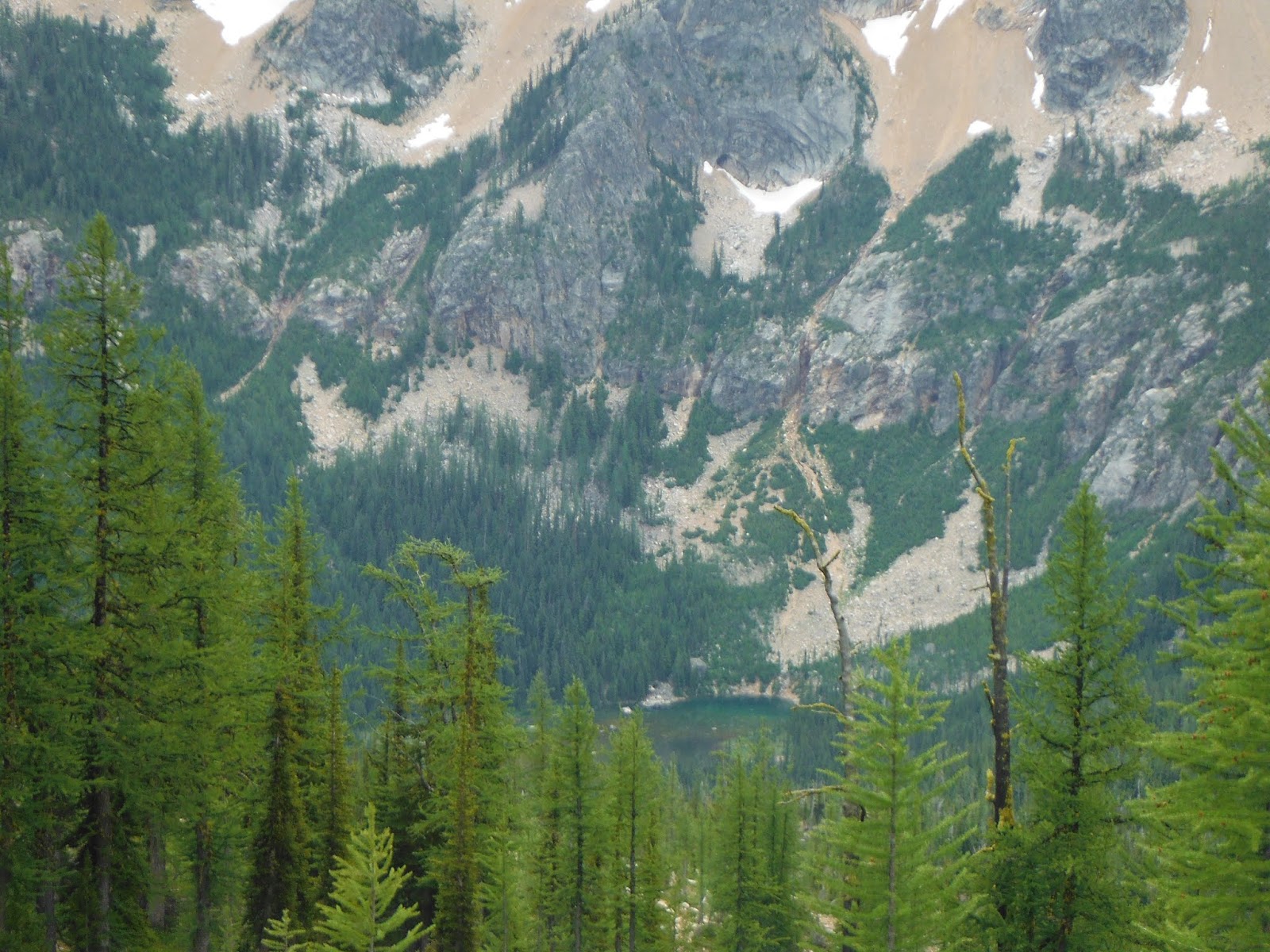
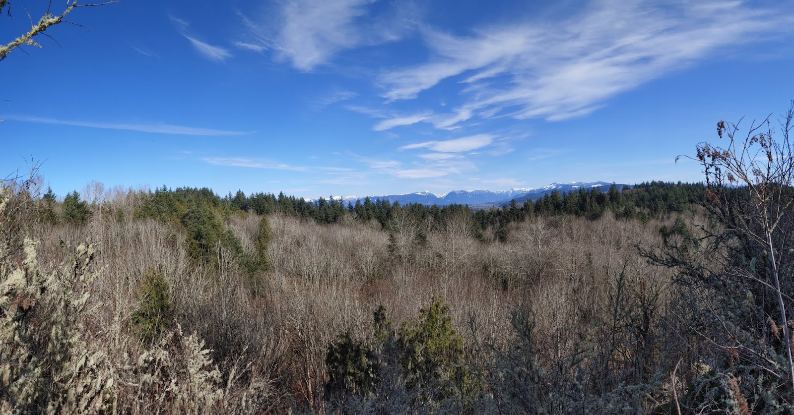
Hiking on a Thursday afternoon, I worked my way down the Red Barn trail, and ultimately to the 630 Viewpoint, that looks west over Hwy 522 towards Seattle and the Olympics beyond.  When I arrived, an Oregon Duck alum named John was on his cellphone.  We cant't really expect solitude in park, but since I was about to eat lunch, a little quiet would have been nice.  Instead, it felt like sitting in a restaurant with a guy in the table next to you talking loudly on his phone.  John didn't really modulate, nor did he make much of an effort to shorten his call.  I suppose he figured he was there first.

I could have decided to be upset at his breach of hiking etiquette, but instead, I decided to go with flow, and eat mt PB & J on a rock as planned.  His conversation rambled on as I focused on the distant vistas beyond.  While he was still on the phone, a friendly, medium-sized dog came up to me looking for a handout.  Turns out it was John's dog, Dusty.  For a moment, John turned from his conversation to say, "I hope he isn't bugging you."  He really wasn't, and wandered off disappointed when he discovered I wasn't in a sharing mood.

Eventually, John got off the phone, and offered to share a new map of the park and give some background on a few of the trails.  Historically, Lords Hill has been notorious for a lack of signage and inaccurate maps. Apparently, a renegade trail blazer named Dave, is building new paths throughout the park.  According to John, park officials tried to bring him in the planning process in some official capacity, but Dave is not interested in the bureaucratic strings that might limit his capacity to build a trail where he wants it to go.  He sees his mission as blazing rugged trails for hikers that discourage mountain bikers and horses whom be feels are tearing up the park.  He has an aesthetic appreciation for nature which the old utilitarian roads and railway grades that became the core of the park's trail system dramatically lack.

John thought the Midway and Riverview trails were the work of Dave.  In one of my rambles, following orange blazes, I might have crossed paths with him.  I thought he worked for the county.
I think John sees him as a folk hero.  When I that mentioned that trails need to be surveyed and cut to avoid erosion, he told me hikers don't cause a problem, and big logs are left on the trails to discourage horses and bikes who create a muddy mess of things.

I also learned that "Meet Cutter" was not a trail named by hungry carnivorous mountain bikers, but an old logging rail grade to a private residence of the Cutter Family who warn off trespassers with a sign featuring a gun barrel.

Before John and I parted ways, I told him I thought it was interesting that the park ranger cared so much about Dave.  In my nearly two decades of hiking, running, and riding Lords Hill, I have never seen a ranger in the woods. "No," John, said, "but I met one at the entrance, where Dusty got a $100 ticket for being off-leash."

https://snohomishcountywa.gov/DocumentCenter/View/63318/Lord-Hill-Trail-Map?bidId=

Wednesday, August 28, 2019

Hiking A World Famous Geological Disaster: The Mt. St. Helens Blast Zone

Panoramic from atop Coldwater Peak
Coldwater Peak, just five miles from the summit of Mt. St. Helens, offers an austere beauty, and on a perfect blue sky day, vistas of five volcanoes including Mt. Rainier, Mt. Adams, Mt. Hood, and of course, Mt. St. Helens.  The other popular hike nearby, Harry's Ridge offers a similar perspective, but Rainier in hidden behind the higher peak.  Without climbing up Coldwater Peak, you will miss out on Rainier. 
Hiking through the blast zone
My best friend, Russ and I left Snohomish County around 5 AM.  Around 9 AM we reach the parking lot at Johnston Observatory.  The visitors' center, where the restrooms are located, doesn't open until 10.  We found a ranger who told us that day permits were required for the trail, but we could check in after the hike.

Russ works his way down the trail

The trail moves north through the bast zone, on a ridge above a valley carved my snow-fed rivers and wind.  For us, the trail was hot and dry, but not overly dusty. Really, there is no shade along the way.  By walking the devastated landscape, we were amazed by the scale of the scene.    Recovery has been slow.  The blast occurred in 1980, and still, the vegetation is a fraction of Rainier.  However, blue huckleberries were abundant along the trail.  
In the hole in the wall, just before the main hill, the rock affords some shadow, but wear a big brimmed hat, and carry SPF 50 sunblock.  I froze a Nalgene bottle that slowly thawed in the heat.  It was great to drink icy water on our breaks along the way.
Locally known as the Arches--really, a hole in the wall
The hike plays much more difficult than the overview would suggest.  About 2000 feet in less than six miles sounds moderate for committed hikers in late summer.  HOWEVER, the trail begins by going down then up, then down, then up.  Essentially, you make a three mile approach before you work up a Mt. Pilchuck-like climb.
The trail begins open and wide, and offers easy miles 2/3rd of the way.  However, once you are on the main hill, above Coldwater Lake, the trail is steep and narrow, brushy, and a little treacherous in a couple of places.  
Seismic Equipment Pointed at the Crater
The seismic equipment facing the great crater creates a Sci-Fi vibe as you reach the summit.  Melted glass is evident at the sight of an old lookout.  Strangely enough, black flying ants were swarming in the afternoon sun at the very peak of the mountain.   They didn't bite, but they weren't great lunch companions.   We moved down from the top a bit to enjoy our sandwiches.  Two ravens and a small hawk soared in the thermals. 
Spirit Lake where Harry Truman made his last stand.
Mt. St. Helens draws folks from all over the country and the world which enriches the hiking experience.  A Swiss mother and her two teenage sons arrived at the summit before us.  A graduate student in Volcanology from Vermont and her mom, came up later.  We met families from Canada and as well as Iowa.  Two educators from Oregon were enjoying the last days of summer vacation.   On the way down, we looked back up the hill and saw a strong mountain goat watch our retreat.
A solitary mountain goat
In the afternoon sun, the undulations with the final up to the trailhead seemed a little gratuitous.  We finished at the observation trail above the visitors' center.  It's worth the few hundred yards of extra work just to see the memorial to those who lost their lives on the mountain including Harry Truman and David Johnston.  

At the ranger station, we checked in, so that our numbers counted towards the total visitors.    The bathrooms were open.   We spent some time looking at the displays.  Looking at the models, photographs and video of the eruption made the hike even more meaningful.  Despite the heat and austerity of the hike, we both felt it was epic!
Memorial to those lost on May 18, 1980
(located where the visitors center trail meets the Boundary Trail)

Saturday, August 24, 2019

Tubal Cain, the site of a 1952 B-17 Crash

As a fan of both aviation and history, I've been interested in the Tubal-Cain trail, since I first saw Jeff Layton's article in the Seattle Times about the B-17 crash in 2015.   However, the trailhead is deeply tucked away in the Olympic National Forest, so the trip from my place is a bit of an odyssey.  Luckily, a good friend of mine retired to the peninsula a few years back.  I walked on the 7:10 AM Kingston Ferry for $8.35, and he met me in Kingston.  We were at the trailhead by 9:30 after missing the turn off by a few miles on our first try.

The trail is in excellent shape with a new log bridge a 100 yards from the start.  The elevation gain is so gentle the first couple of miles that good conversation makes it hardly noticeable.  As promised, rhodies line the trail, but they were done blooming quite awhile ago.  Given the remoteness of the trailhead, we encountered quite a few hikers on a Friday morning.  About half were backpackers including a big group from Portland.


The Tull Canyon cut off to the airplane crash was pretty apparent to us, but the small weathered sign in the forest doesn't exactly flash in neon.  Go left, and up the steepest part of the hike at the junction.  The mine shaft is just above where the two trails meet, but we saved it for the way out, since the crash site was our first objective.  
Working your way up to wreck is some work, but it's over in a half mile.  The debris field is scattered through a small creek, and I imagine August is a good time to visit.  We were amazed at how brilliant the metal still gleamed after all these years.  Unfortunately, some tagging and vandalism is apparent.  I suppose, since 1952, prime pieces of the wreck (i.e., props, yoke, etc.) have long since disappeared into garages and basements of scavengers.  Regardless, what is left is still impressive.

We headed back after lunching at the camp above the crash site.  The mosquitoes required  counter-measures.   Throughout the summer, I hike every week, and this was only the second time I turned to Jungle Juice.  We did stop at the mine on the way down, but were frankly underwhelmed, probably like the original investors.


The Forest Service Road out was definitely busier in the afternoon.  While it only washboards in a few places, it is pretty narrow, and swerving could result in very ironic crash down a canyon.
I made the 4 o'clock ferry (no fare collected for East bound walk-ons), but I should have stayed on the Peninsula longer.  I arrived back on the east side of the Sound just in time for peak rush hour. 

Wednesday, August 14, 2019

Ridge Lake via Kendall Katwalk: Snoqualmie Pass


I have mixed feelings about the popular Kendall Katwalk.  On the one hand, it offers amazing vistas of rugged crags and dark green valleys, the kind of landscape that normally requires a day's journey to the North Cascades to see. With the Kendall Katwalk, an hour drive from Seattle, and another hour of hiking, and you are above the treeline wandering through austere beauty inaccessible to the masses .  On the other hand, the trail seems like a throwback to the 19th Century when avaricious men with black powder, and later dynamite, blasted their way through natural obstacles to reach pay dirt in the form of minerals, trees, or trade. The work here was done in the 1970s, ironically to complete a difficult section of the Pacific Crest Trail.

Despite my sense of ambiguity, we headed out on a beautiful morning,  arriveing at the trail head a little after 9 AM.  We left the Eastside of Seattle around 8 AM and encountered reasonable summer traffic for a Tuesday morning.  It's always a trade off when hiking in the I-90 corridor--proximity versus crowds.  We found the main parking lot nearly full.  Fortunately, the trails we're not overly crowded. 
The Better Creek Crossing on the Old Commonwealth Basin Trail

One of the cool aspects of the hike is the cross-section of day hikers, runners, and backpackers you encounter along the way.  It seemed to us that nearly half of the boots on the trail were thru-hikers coming down from Stevens Pass.  One couple endured the deluge of weekend rains a Waptus Lake that added a dry out day to their total of a week.  A father and daughter, with streamlined packs like PCTers, finished the journey in five days.

Out of the parking lot, we elected to take the Old Commonwealth trail, (recommended by a friend) which begins just a few hundred feet on the left, past the trailhead.  Officially, we discovered, the trail is abandoned.  It is brushy and steep with more roots & rocks than a Bob Marley album.  It may have save some time, but I got soaked pushing through dew heavy leaves.

At an interesting washed out creek crossing, we encountered a couple who were trail running.  Slightly disoriented, they wanted to know if they were on the right path out.  We assured them they were navigating the trace towards the parking lot.  Soon the sound of water would be replaced by the sound of the freeway.

At the end of the cut, we turned right onto the start of the Commonwealth Basin trail.  In 200 feet, we rejoined the PCT trail with a left, and continued the climb up the forested ridge. 

Eventually, you pop out of the woods of some amazing views to the Southwest of Snoqualmie Pass and Mt. Rainier.  We found some paint brush and fireweed in bloom.  The hardest part of hike is the work acquiring the ridge.  As you switchback up, Red Mountain contrasts strongly against a range of grayer granite. 

For me, the trail doesn't feel as long or as difficult on the way in as the guide indicates.  Perhaps we were lucky to start in cool of the morning, gaining elevation through the forest.  At any rate, we met a number of Senior hikers working their way up the trail, who seemed to be easily handling the challenge.

At the top of the ridge, the Katwalk is an impressive testimonial to engineering.  I suppose it solved a nasty geological snarl created by the congregating peaks above the pass, and it made it Section J of the PCT passable.  There's no arguing about the views, either, though gouging a trail out of the mountain granite  to create greater access to wilderness seems a bit hypocritical. Of course, some people stop here and eat lunch. 

We continued on to the Ridge Lake.  With our route, we recorded just under 7 miles in 3 hours.  Hikers coalesced here.  Two golden labs were splashing in the water.  We hiked to the quieter end of the lake though truth be told, the amphitheater acoustics of the cirque did little to quell the raucous exuberance of man, woman, or beast.  Bugs were present but not a bother compared to a trip we made two years ago. A light breeze thwarted their sinister intents.

We enjoyed wading in a bit to cool our feet.  Trout jumped obliviously.  As we were packing up, a group of fly fishers arrived to dance their lines above the water.
The hike out provides a better sense of the distance in.  With tired legs, and lagging conversation, the easier miles out felt longer, even though we were back at the trailhead in just 2 1/2 hours.  On the way down, we crossed paths with a teenage couple in blue jeans already out of water.  Maybe the heat of the afternoon wouldn't bother them at all.  Personally, I drank about a quart of water.


Wednesday, August 7, 2019

The Flowers, Falls, and Bear of Spray Park in Mount Rainier


Late July or early August is the best time to see the display of wildflowers in Mount Rainier National Park in full bloom.  Grand Park and Summerland are both beautiful destination, but perhaps the best is Spray Park.

On a recent Tuesday morning, we decided to head south to see the spectacle.  The trip to Mt. Rainier has gotten longer in recent years from the Eastside of Seattle because of our notorious traffic.  Luckily, there were three of us, and we were "good to go" in the carpool lane through the worst of the snarls that began in Kirkland and continued all the way past Kent.  Of course, if you are not a daily commuter, you'll need to plan in advance pick up the pass at Fred Meyer or QFC and open an account on-line.

A small bridge has been out on 165 near Buckley for almost a year.  Pierce County, named after one of our great incompetent presidents, seems to be living up to its namesake on this project.  Expect an odd delay and detour on the edge of suburban sprawl.   

The dirt road in the park to the trailhead is in pretty good shape with a little bit of washboarding.  At the trailhead, you'll find all types of vehicles from a variety of states and provinces.  We rolled in at 9 AM on a Tuesday.  Parking was filling up.

As we drove down to the park, we were a little concerned about the Puget Sound marine overcast obscuring views of the mountain, but by the time we arrived, it was mostly gone with just a lingering of haze.
First good view of Mt. Rainier from Eagle Cliff

The hike starts at Mowich Lake Campground where there is access to a small beach, a few campsites, and a privy.  The trail begins by going down then climbing back up the ridge.  Since you begin the hike at 4900' and climb to 6000', the total elevation appears to be pretty easy.  We found all ages on the trail from toddlers riding on their parents' back to octogenarians.  That be said, the roots, mud, and undulations of the trail definitely create some work with some serious switchbacks after the falls, and of course, the final climb back to the trailhead on weary legs at the end of the hike.
Spray Falls

The first glimpse of the mountain in all it's glory is just a few steps off the trail at Eagle Cliff Lookout.  Shining Mowich Glacier glistens just a few miles away.   Here we met an intrepid senior hiker named Tony, from Gig Harbor.  He moved to the the Northwest years ago as a young man for work and beauty.  Decades later, he is still venturing into the mountains.

The next side trip we made were to Spray Falls.  We were impressed by the splaying diaphanous veil over the cliff.  If you stay on the main side of the creek, you'll see 80% of the falls.   I crossed over to get a better look.  The rock hopping, creek crossing is a bit tricky on slippery boulders.  Our new friend, Tony, with a decade or two on us with accompanying wisdom, decided that discretion was the better half of valor, and took his photos from the safer side.
Lupines along the trail in Spray Park

The switchbacks up to the park from the falls are steep with roots and mud.  You poke out of the woods briefly to see the mountain in its glory, then climbed again to meadows where bouquet of flowers are in full bloom. 
Unconcerned by our presence

As we moved up the park, a big bear with cinnamon highlights to his coat grazed nonchalantly off the trail 20 or 30 yards away.  He was grubbing about in a seasonal brook and didn't seem to care about hikers passing by and taking a quick photo or some video.
We continued up a trail lined in blue lupines and sparks of red paintbrush to the Upper Park, and ended up eating lunch on a moonscape ridge that marks the edge of Spray Park's floral beauty.  Here a hint of the true nature of mountain's volcanism is apparent in red and gray chunks of lava rock. 

Several parties of Wonderlanders were wandering by.  A party of three lunched near us.  They had spent 6 nights on the trail, and were looking forward to a dip in Mowich Lake.

Bugs were noticeable at lunch, but not a nuisance.  None of us dug out bug spray, but maybe folks with sweeter blood might want to have protection at the ready.
The trip down was highlighted by a trail-side conversation about a sow and her two clubs up the ridge from the trail.  With naked eyes, the bear family was only brown specks moving between talus fields.  Luckily, a kind gentleman with binoculars let us have a closer look where we could see playful cubs tagging along behind their mom.  Note to self:  Bring binoculars next time, and spend a moment glassing the mountain beyond the trail.

The afternoon heated up, and one of my friends filtered cold water from a stream on the way out.  The final up before the trailhead seems a little unfair but we cooled down in the lake afterwards and reflected back on one of the best day hikes of the summer.

Sunday, July 14, 2019

Harts Pass to Rainy Pass in the North Cascades

People claim that the section of the PCT from Harts Meadows to Rainy Pass is one of the prettiest, so we left a truck at Rainy Pass, and had friends take us to the trail head at Hart Meadows.  The road to the trail head is narrow in places, but improved, according to our driver.  We originally had planned to start at the pass, but impending rain convinced us to cut off a couple of miles and start at the meadows.


The hike began with a bit of a march up the shoulder and around Tatie Mountain. For me the steady work up four hundred feet of elevation felt more like a thousand under the weight of my first big backpack trip of the summer.  The shoulders and back were feeling the pressure of my future comfort and over-preparation, even as a twenty-something PCTer ran by me with a pack half the weight.

The trail starts with broken rock and sand and climbs at a fair grade skirting the edge of an old forest fire.  The basin is tamarack and spruce. Wildflowers are in full bloom.  After the saddle below Tatie, the trail holds most of its elevation for nearly five miles as it turns more directly south towards Glacier Pass.  On the way, we saw brief, stunning views of Mt. Ballard and later, Azurite Peak during breaks in the clouds.


We wanted to start off easy, and looked for an early camping site.  However, the more exposed spots at Glacier Pass looked less inviting to us in the presence of threatening weather.  We soldiered on down 1,200 feet towards Brush Creek where we were hit with solid rain.  Bush Creek looked hospitable enough of a camp, but, hey it was only 3:30 PM, and we asked each other, “Who wants to sit around camp, doing nothing when the sun wouldn’t be setting until after 9?”  If we had stayed at Bush Creek we would had a much more enjoyable evening.  In our ignorance, we continued down the trail.


From the woody, Bush Creek camp, we hiked into a solid rain on the worst part of the trail.  Trailcrews hadn’t cleared the section this season, and in a number of places the vegetation completely hides the trail.  If the rain doesn’t soak you, the salmonberry and Solomon’s seal along the way certainly will.  A few blown down trees were mixed in to make the little 2 1/2 miles journey unnecessarily hellish.  Luckily, it was a warm rain.  We opted only to cover our packs and not pull on rain gear for the short distance.  Our cores stayed warm from the work, but our boots were drench.  It was a stupid day not to wear gators.


The Methow Trail Camp was a welcomed site.  We were able to find decent spots to put up our tents among the tree before the onslaught of PCTers came crashing in.  At least ten arrived after us.  I felt sorry for the ones eating granola bars or a gel for dinner before crawling into pup tent without walls or a floor in the rain.  The forty pounds of comfort I was carrying felt worth it that night.  The trip so far was mostly down hill. The next day would cover half the miles but climb from 4300 to 6500 feet over 8.4 miles.


Making our way up to Methow Pass, we started in the forest that was humid after the rain.  We lounged around until ten before leaving camp.  The PCTers were all long gone by then.  The first part of the day was nice, but the 1000 foot ascent after crossing the treeline is some work concentrated in a short distance.  The view from Methow Pass was sublime, and we dropped down to camp below Snowy Lakes.


On Thursday night we were the only ones at the lower camp.  A couple tented up a few windy nights at Lower Snow Lake, but we preferred the shelter of the saddle below.  Some mosquitoes proved to be only a small irritation. The evening was pleasant, and while it started out windy, the night ended still and cold.  We woke up to a little bit of frost.  I climbed the steep, rough trail to Lower Snow Lake and was treated to the beauty of Golden Horn Mountain reflected in still waters of the lake.


On Friday, we headed towards Granite Pass along a trail cut into the edge of the ridge.  In a few slide spots, you need to be attentive.  The steep talus slope looks pretty unforgiving.  The switchbacks above Granite Mountain acquire several hundred feet in a hurry, and I felt the work. Before connecting with the ridge trail to Cutthroat Pass is a small but steep snow field.  We used trekking poles without traction and felt comfortable.  Earlier in the season, or in a snowier year, an ice axe and microspikes would be worth the added weight.


As we turned towards Cutthroat Pass, the PCT hikers were replaced with overnighters and day hikers.  Some came up from the Cutthroat Lake trailhead while others worked their way from Rainy Pass.  We thought we would see what campsites were available at Cutthroat Pass.  Really, the only one with a great view and good water was already taken by 1 PM.  We had a nice chat with some Canadian hikers who were only a couple of comfortable hours out of Rainy Pass, we elected to head out for a burger and beer in Marblemount.

Saturday, March 17, 2018

Cherry Creek Falls on St. Patrick's Day


Cherry Creek Falls is always a favorite destination for our hiking club.  Parking, as reported can be problematic, especially on weekends.  Laurie, our local Duvall guide, recommended that our group both carpool in, and park on the trail-side of the road at angles to let more folks enjoy the trail. 
The hike is short with little elevation gain, and the falls are quite pretty most of the year.  With good conversation, the 2.5 miles to the falls go by quickly.  Of course, if you are not paying attention, it is easy to take the wrong turn to Monroe, if not Albuquerque.  Old logging roads, with side trails, abound.  However, the path is well worn, muddy, but easy to follow.
Since our visit in the fall of 2016, some signs have been added along the way--we guessed by a young Eagle Scout.  On the in, we chose the muddier, lower trail, on the right at the junction below the hill. This route is more open though it passes a couple of old wreck cars.  It also includes a stream crossing with a log that was difficult for the young lab in our party.  Ellie wasn't about to cross it by herself, so her owner, Gary, carried her wiggling to the other side.  While Gary didn't quite stick the landing, it was still a nice demonstration of balance and concentration, but not one he wanted to repeat on the way back.  

The lower trail makes a less dramatic entrance to the falls, approaching from downstream.  Still, the volume of water crashing down was impressive for a little creek.  For a moment, we thought perhaps the luck of the Irish might be with us when we spotted a little green man on St. Patrick's Day.  Turns out he wasn't a leprechaun, only a cheap garden gnome.   We also missed out on the pot of gold.  However, we snapped some lovely pictures and headed back, taking the upper trail.   A couple of creek crossings are required on this route, too, but with some encouragement, we convinced Ellie to splash through on her own.
We were back at the car by noon, so grabbed tasty burgers in Duvall at  Pickle Time.